Vermillion Valley Resort – Bear Creek

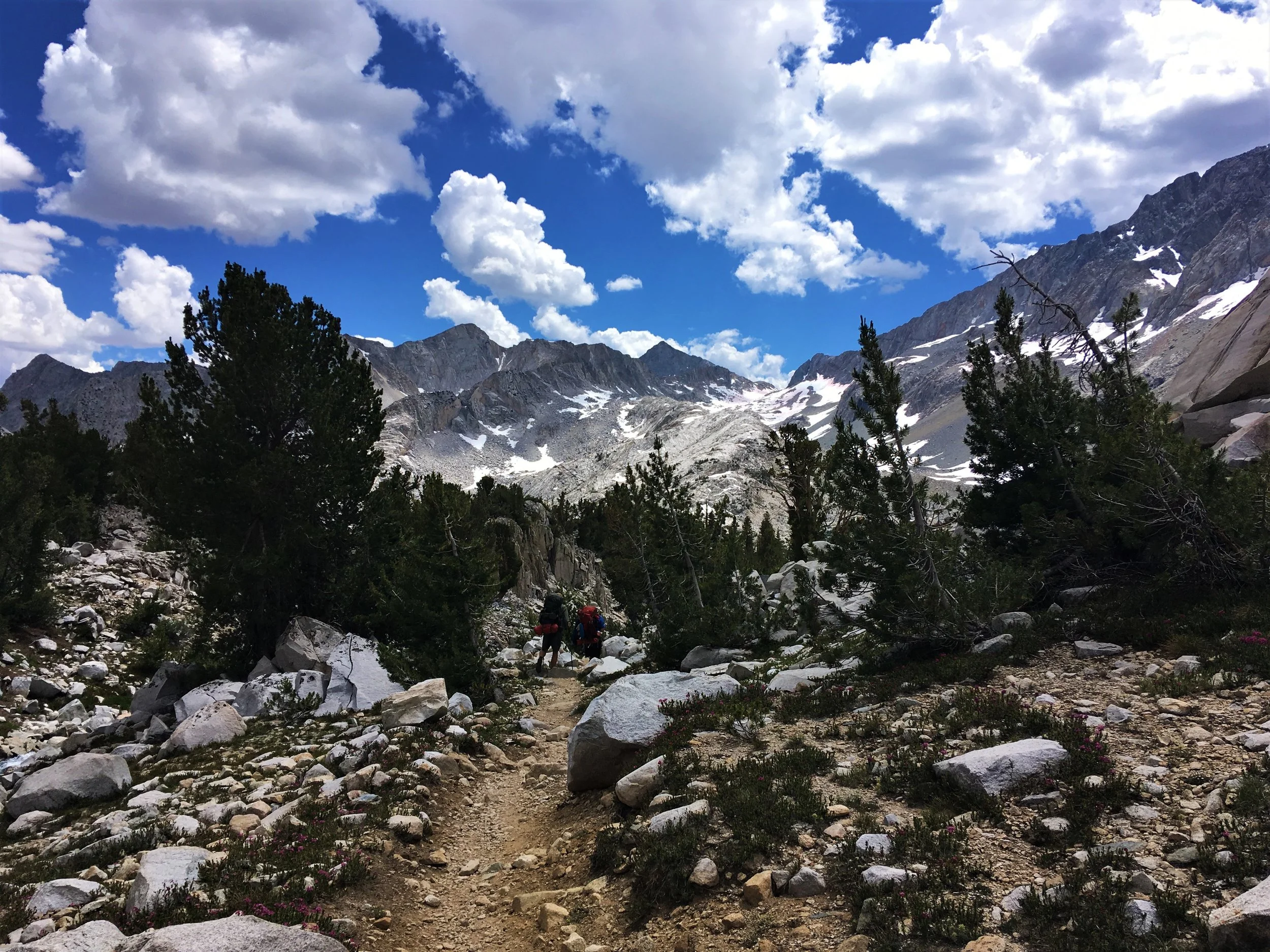
My oh my, are we turning into power balls! We walked the 19 km to Bear Creek, 8 of which were steep uphill switchbacks, in less than six hours including breaks. Bear Creek was our sketchiest river crossing so far, but we luckily found a log to ease our passing.

 
Taking the ferry back across Lake Edison, headed yet again into the wild.

Taking the ferry back across Lake Edison, headed back into the wild.


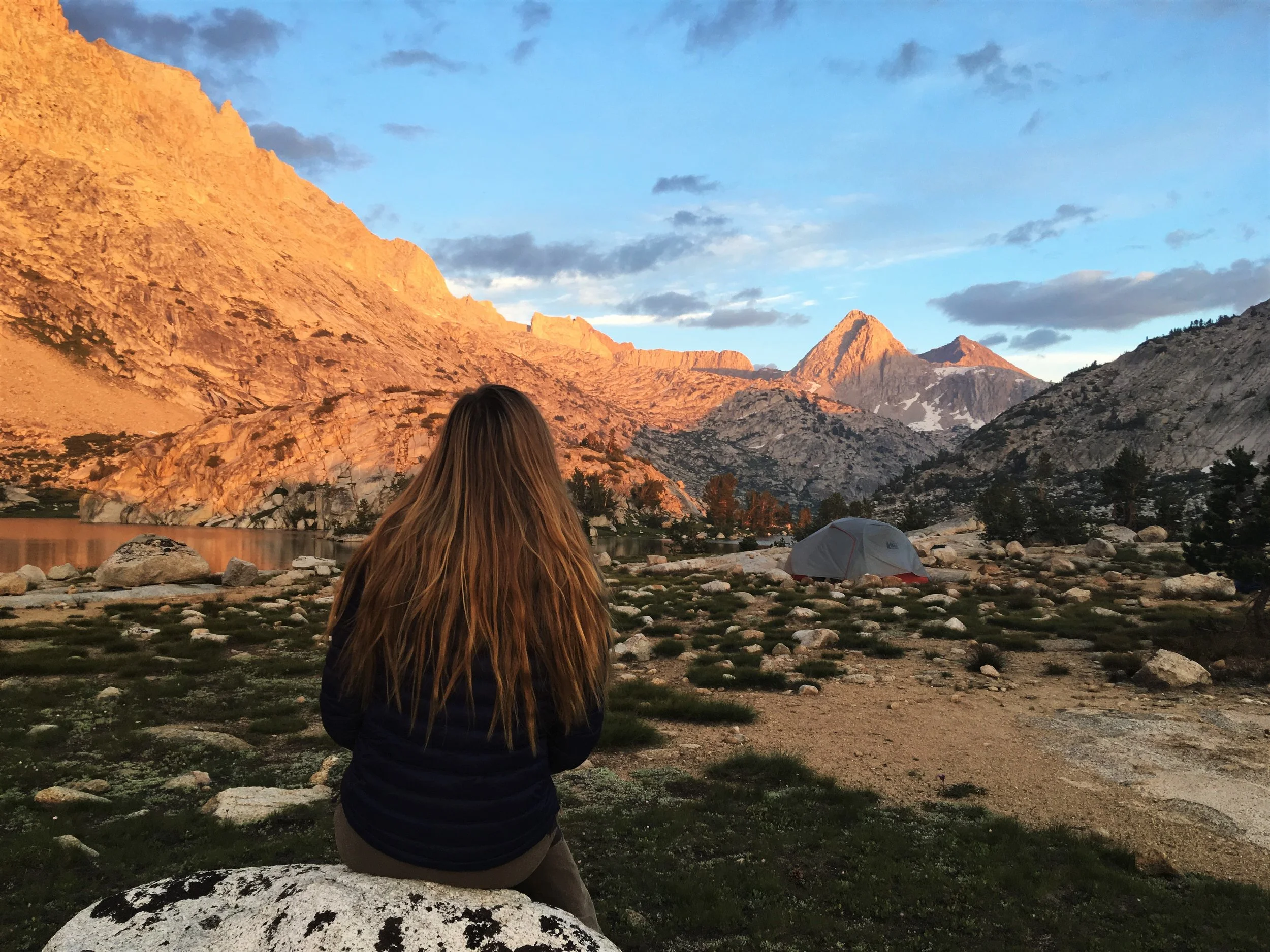
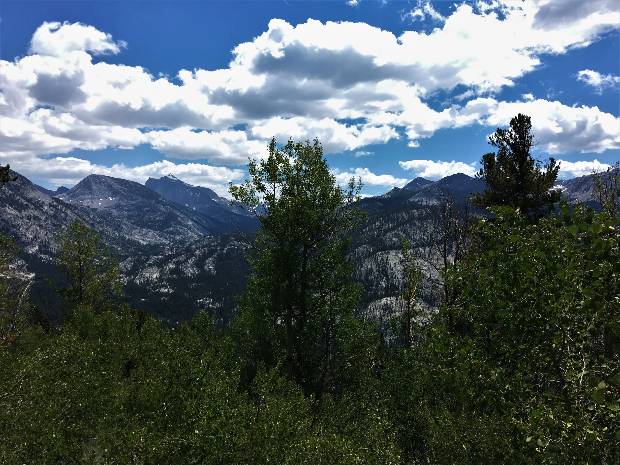
We were already tucked in at 18.00, sleeping bags fluffed up and teeth brushed. Today was all a blur of new mountain views, aspen forests and autopilot hiker mood. Our packs were loaded with stuffed bear cannisters, but it didin’t feel nearly as crippling as on the first day from Rush Creek. On the other hand, I still longed for a bed. My sticky sleeping bag liner smelled, I smelled, the tent smelled, everything smelled. My face was covered in salt from sweating all day, and the brown dirt forming in the cracks of my fingers stubbornly refused to be scrubbed off.
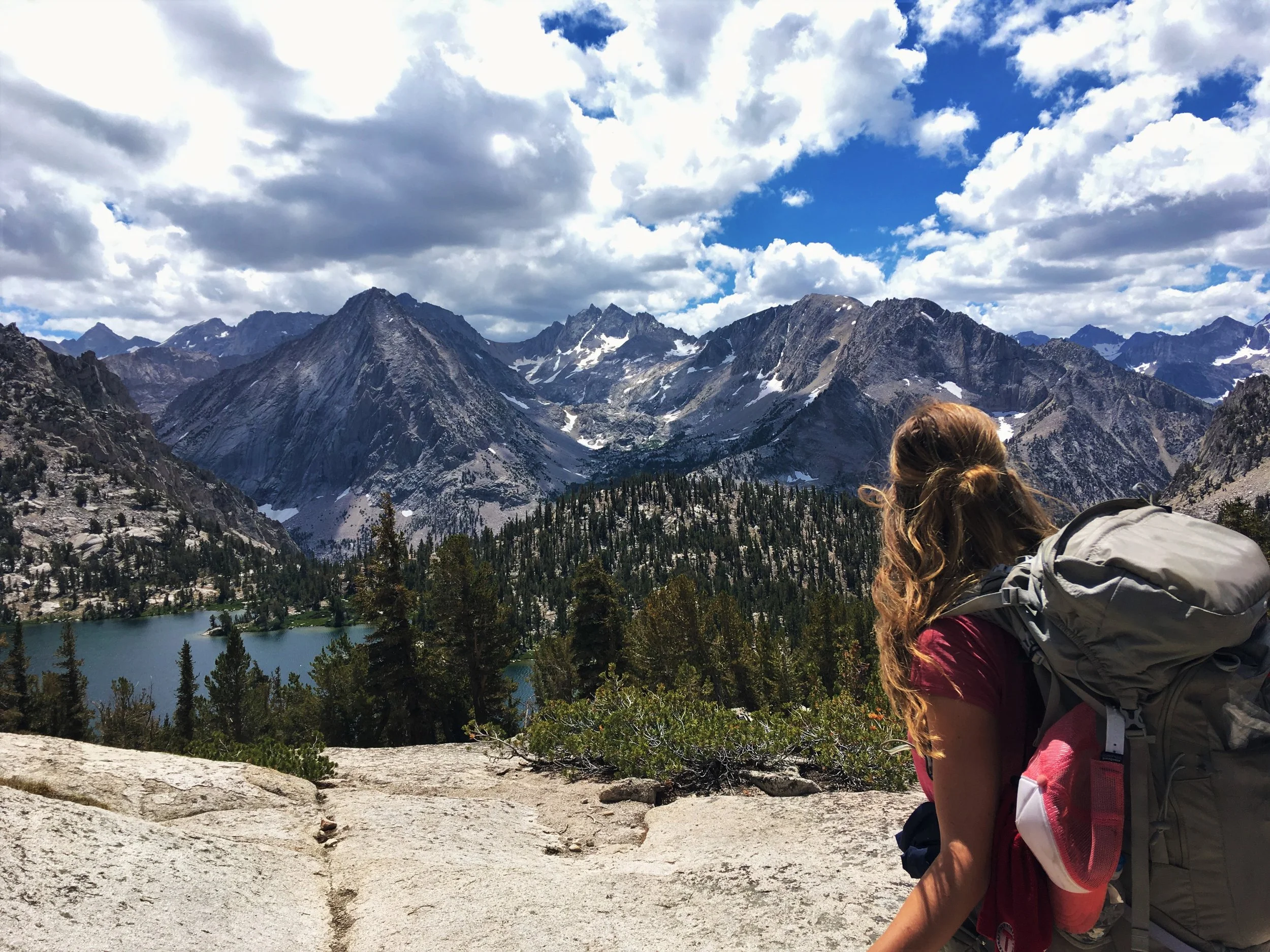
 
On the Bear Ridge

On Bear Ridge


After a zero day, it struck me that one of the defining features of backpacking is how unavailable everything is. If you want something in your regular life, all you do is reach out and grab it. Worst case, you walk a few minutes to a store to buy it.

Here, I had no options. I had to eat the exact supplies for the day, no matter what they were. There is something incredibly liberating about carrying all you need on your back, but I’m not going to romanticise it overly. There is no margin of error, a missing item can be disastrous.

I sacrificed my book to compensate for the heavy food, and already regretted it. Some of you must be thinking “how can she be so unappreciative of nature?”, and I don’t blame you. But when all you see is nature 24/7, you grow desperate for entertainment. A movie, any movie…

I guess that’s why these trail adventures are rumoured to be so introspective.

D8_4.JPG

Bear Creek - Piute Pass Trail via Selden Pass

Off to a moist start. Mood was sour as we examined our soaked tent and sleeping bags after a night of full-blown condensation. The curse of the single-walled tent. We had to carry the wet gear outside our packs, and we saw countless other hikers in similar dismay as we crossed dewy meadows in the chilly morning. The only small blessing was that my period, having realised our trail adventure was not over, glumly retreated. Who knew that vigorous activity could impact your cycle…

 
D9_1.JPG
 

My morning hate slowly evaporated on the long climb up to Selden Pass. Who can be gloomy at the sight of shining crystal lakes, purple mountain flowers and chipmunks begging for nuts? Selden Pass itself was a sweaty but gorgeous ordeal. I could look at the landscape beneath the passes forever. Both Selden and Silver had been relatively miniscule, and not high enough to be stripped of vegetation. I knew the giant passes still lay ahead, but it felt comforting to know that we’d traversed the “baby passes” without any trouble. When you’re undertaking 340km of hard terrain, you hold on to the little victories!

 
The lower north side of Selden Pass

The lower north side of Selden Pass


The north side of Selden Pass and Marie Lake

The north side of Selden Pass and Marie Lake


We gobbled an uninspiring lunch of ramen noodles by beautiful Heart Lake, and meandered down through lush forests and meadows blanketed in wildflowers. As we made our way down endless switchbacks, losing all the altitude we had gained since leaving VVR, I couldn’t help but think that this trail could have been made slightly more intelligently. It was a constant up and down scramble, why didin’t it ever follow the side of a mountain for a while? Tomorrow was the last day before our first big pass – Muir – and I worried constantly about altitude acclimatisation. After the experience at Squaw Lake, every camp now felt momentous.

Sallie Keyes Lakes

Sallie Keyes Lakes

Aspen forest at Sallie Keyes cutoff

Aspen forest at Sallie Keyes cutoff

For the first time since our hike began, the afternoon brought puffy grey clouds. Hikers dread afternoon thunderstorms, but luckily we were nestled amidst sturdy pines at lower altitude. Not five minutes after we reached camp and pitched our tent, the first rain of the trail came pattering down. My Duplex did well in the rain, but it took a good two hours of rumbling thunder before we could crawl out to filter water and make dinner. The campsite at Piute Pass trail wasn’t much of a stunner; but made up for it in cosiness. We could enjoy the distant chatter of other hikers, and the sunset burst through the clouds just in time for me to eat my (unspeakably delicious) chili mac in golden light. No bugs, for once we could linger for as long as we liked to stretch, talk and laugh before crawling into bed.

My hair took almost ten minutes to brush. It’s morphed into one big dread at the nape of my neck. We smelled so bad that no amount of airing out made my tent smell like new. And yet, you slowly get accustomed to this reality. Hardships take their toll, but if you can end the day in tranquility and beauty, you feel as content as can be. Embrace the tunnel vision for all its worth, as you watch stars pop up in the night sky above your head.

 
D9_8.JPG
 

Piute Pass Trail - Evolution Lake

Any condensation-free morning is a good morning, right? Despite another dose of tasteless ramen noodles and an ever-growing bruise on your ankle. Right? Right. For once the terrain was flat, and we made good speed through the Evolution Basin. We were treated to a circus of wildlife all morning. Two chipmunks chased each other in a merry-go-round fashion around a tree trunk. Twin fawns peeked curiously out at us from behind a bush. I choked on my breath as I narrowly missed stepping on a long, thin snake before it slithered off the trail.

 
Claw markings from a bear on a tree kept us alert, but today is a Snickers day – glory!

Claw markings from a bear on a tree kept us alert, but today is a Snickers day – glory!


The trail winded upwards through spacious woodland, and we easily crossed the now meek Evolution Creek, where several PCT hikers had drowned only two months before. A few miles later we ran into Theodore, a witty Mexican-American by the trail name Billy Goat. He gifted us some gummies and electrolytes, that unlike ours tasted great and looked radioactive inside the bottle. We enjoyed his good company and lunch at McClure Meadow. He also gave Adrian his trail name, after half a second’s deliberation: Legs.

D10_4.JPG
D10_3.JPG

It felt like a monumental decision to continue up to Evolution Lake for a high camp and a strategic position for Muir Pass. I was freaked out by the altitude - but staying at McClure Meadow meant a hideously long day tomorrow and slushy afternoon snow. Muir Pass, unlike the other high passes, doesn’t have a cone-shaped elevation profile, but is rather like a speed bump. Traversing the south side would take hours.

Billy Goat taught us how to go s-l-o-w on the uphills, and it really worked! We inched our way up the switchbacks, meeting two Texan students on the way. Dan and Andrew shared our amazement as we rounded a bend in the trail and beheld Evolution Lake for the first time. It was one of the most stunning sights I’d ever seen. The green lake and white stones beneath the majestic Evolution Crest which craggy peaks shot up into the sky. Blowing up my Thermarest in the thin air took close to 15 minutes, every breath had to be slow and deep to be even vaguely satisfying.

 
The Evolution Crest - the camp of a lifetime

The Evolution Crest - the camp of a lifetime


But the beauty of Evolution Lake was beyond words. It ached just to look at it. The alpenglow on the mountains created a wonderland of pinks, apricot, baby blue and violet. The sun set blood red, low on the horizon as we wandered around drinking it in. Every cell in my body tried to absorb the wild land and store it in memory. For the first time, I didn’t want to go to bed, I hated the thought of even a thin tent mesh between me and this wild, wild place. What a wild life!

Alpenglow and the southbound trail

Alpenglow and the southbound trail

Mountain Bambi <3

Mountain Bambi!

The northbound trail

The northbound trail

 
“There is a sunrise and a sunset every day. And you can choose to be there to see it. You can put yourself in the way of beauty.” - Wild

“There is a sunrise and a sunset every day. And you can choose to be there to see it. You can put yourself in the way of beauty.” - Wild


 Evolution Lake - Big Pete Meadow via Muir Pass

Does it get boring to receive the morning report? Sleep: meh. Condensation: Some. Mood: reasonable. Power breakfast of tortilla with almond butter and chocolate spread: holy macaroni. Those flimsy oatmeal packets ain’t got nothing! The 1000 calorie tortilla combo turns you into a Duracell rabbit on ecstasy. I was ready to run up Muir Pass, 65L backpack and all.

The trail from Evolution Lake to Muir Pass was, in short, dazzling. We crossed the wide Evolution Creek again in the morning mist, hopping like bunnies on our tippy toes on the strategically placed rocks.

Soft snow, grassy patches, white sand trail, silver mountains, sapphire sky, deep glistening lakes, M&Ms in my side pocket… It’s always sunny here. Walking up felt like walking into the sky.

The air was so thin I had to inch myself along, but the gentle terrain spooned me in towards the magnetic pull of the pass.

Crossing Evolution Creek fed with water from the glaciers

Crossing Evolution Creek fed with water from the glaciers

 
D11_2.JPG
 

Traversing the high passes takes pretty much all day, especially one with such gentle slopes as Muir. There was never a point where we had to battle our way upwards, the easy gradient allowed for a smooth stride. Now the large snowfields started to appear, and I got a better idea of why everyone was concerned about slushiness on steep slopes. We carried neither micro spikes, crampons, or ice axes, but none of them would do you any good once the morning sun melts the snow crust away. We meandered along the glass-clear shores of Lake Wanda before the landscape turned to snow and scree.

The sapphire shores of Wanda Lake

The sapphire shores of Wanda Lake

Looking towards Goodard Divide & Muir Pass

Looking towards Goodard Divide & Muir Pass

At noon I heaved myself up the final slope and could embrace Muir Hut. Who needs summits when you have passes on a thru-hike? We were surrounded by barren moonscape in all directions, Himalayan craggy peaks jabbing at the sky. Clouds drifted around teasingly, but still the sun scorched us. I had a tiny square of caramel chocolate to celebrate, I felt like I was unwrapping a Wonka bar – the golden ticket all around me. The Texan students joined us along with a friendly girl, Carly, and her service dog Zia. Zia would give me several heart attacks that day. She delighted in throwing herself down the steepest snow slopes, I was convinced she would fall to her death on the rocks every time. I could have stayed at Muir Hut to bask in our accomplishment, but we decided it would be safer to descend as a group.

 
Happy hikers at Muir Pass, 3650 m

Happy hikers at Muir Pass, 3650 m


Navigating the south side of Muir was… wild. Without Guthooks maps we’d be fried, snow fields covered huge chunks of trail. We spent several minutes scouting the vast slopes for our precious path, sometimes finding it, sometimes not. There was no clear track, and we had to wing it several times over crusty patches – hearing the rush of rivers spookily beneath our feet. Muir’s south side is significantly steeper, and we inched our way around snow bridges, scrambled over rocks and glissaded down trying to not rake our butts on sharp rocks (“Nonono, Zia! Come back! ZIAAA!”).

 
Walking on the wild side. Algae colours the snow pink.

Walking on the wild side. Algae coloured the snow pink.


I felt my pulse ringing in my ears crossing rivers where a slip would send you cascading into the valley below. The crossings could literally be perched on the edge of a drop. The landscape was so stunning and untamed, it was the wildest place I’ve ever hiked. Hours and hours went by in a tense adrenaline-fuelled focus. By the time we reached the bottom of LeConte Canyon, we’d descended a 1000 altitude metres. My legs buckled underneath me, I was as beat as on day 1 and 2.

 
Zia, Carly, Dan and Andrew living on the edge. The pond drops straight down just past where they are crossing.

Zia, Carly, Dan and Andrew living on the edge. The pond drops straight down just past where they are crossing.


But as reward for our long day, we had a wonderful time in camp with our new friends. Everyone pitched their tents at the Big Pete Meadow campsite.

Carly generously shared her freeze-dried Raspberry cookie crumble dessert with us. Dan & Andrew made a bonfire, and we laughed ourselves into cramps over their attempt to shatter a dead log using primitive tools (read: their hands and a rock).

I recorded it on my phone, and later labelled it Two Texans, One Branch. Long trails are great things in themselves, but the camaraderie amongst hikers is a valuable bonus – the cherry on top of an already outstanding experience.

Levelling out at last

Levelling out at last

Big Pete Meadow - Lower Palisade Lake 

I always reckoned my main enemy on the JMT would be altitude. It’s a strange sensation to draw in breath without feeling satisfied. Your muscles don’t have as much fuel to work on, you move slow and think slow. Tasks take longer, and you can’t do massive mileages because the strength just isn’t there. But as of today, our new top toil turned out to be all the more consuming (no pun intended).

Hunger.

Trying to fit 8,5 days of food into a Bear Vault 500 proved to be a thankless task at VVR. Yesterday I only had a meagre Kind bar for lunch (if you have seen the pathetic size of those things you are likely shaking your head in sympathy now). However creative you get with packing, there simply won’t be room for food to compensate for your exertion.

Snacking constantly is good to combat altitude-induced nausea, but with a metabolism on acid it leaves you feeling even more deprived. Today’s menu: one packet of almond butter scraped thinly across two tortillas, a Clif bar (I can still remember years later that it was a berry pomegranate chia one…), and a handful of dried apricots in addition to dinner.

Definitely not the first time these guys went on a camp safari.

Definitely not the first time these guys went on a camp safari.

IMG_7297.JPG

Thank goodness LeConte Canyon blessed us with relatively undemanding terrain. We fantasised constantly of food. Adrian was already on the slim side and worried he would be seriously underweight by the end of our hike.

I had long forsaken any ideas of a toned trail body, and spent hours daydreaming of grocery stores, bags of beef jerky and burgers. Always burgers. Give me a hiker who doesn’t dream of burgers at least twelse times per day.

Ever since the JMT, I’ve been hesitant to recommend long-distance hikes to couples. I’m very aware that plenty of people do it – I’ve met several doing a thru-hike for their honeymoon – but in general it isn’t a particularly romantic activity.

Never mind the dirt and the smells, but for our part – we were so zoned in on our immediate needs that we devoted basically no time to connect. Hiking while hungry isn’t great for the mood, and we would squabble over meaningless things like sunscreen application.

LeConte Canyon was lush with aspens and plenty of curious wildlife; but baking hot in the sun. I could cruise once I got my head in the zone, but I’d still be thinking semi-constantly fuck I’m so hungry. That deer looks tasty. If we found a dead animal, would I eat it? Hell yes I would.

 
Looking back down into LeConte Canyon and the northbound trail

Looking back down into LeConte Canyon and the northbound trail


I must have been in the middle of one of these drooly daydreams when I almost bumped into Adrian, who had stopped dead on the trail. Looking past him, I could see why. The whole level ground narrative was over. We had to crane our necks to look up at the wall in front of us, the notorious Golden Staircase. A rock massif almost 700 m high, it takes ages to climb and there are no water sources. To be fair, it offered splendid views of the canyon below, but it was two winded Norwegians who crawled over the top. I’d also paid for my pee-break with about 45 new mosquito bites.

 
Heading up the Golden Staircase. You can’t tell how steep it is, but the camera angle is pointed almost straight up.

Heading up the Golden Staircase. You can’t tell how steep it is, but the camera angle is pointed almost straight up.


Finally we beheld Lower Palisade Lake. It would be our camp for the night. As we traced the edge of the lake, stormy clouds gathered, and I lay down the line for any higher altitude camping. Tomorrow morning we would face one of the most dreaded passes on the JMT: Mather Pass. The north side is steep and slippery, the snow would be icy in the shadows. We will be doing one pass per day until our next resupply. We lay in our tent, starving and scratching our bug bites, as the hours towards an appropriate dinner time ticked by.

 
Lower Palisade Lake

Lower Palisade Lake


It feels strange typing this out from the comfort of my kitchen after all this time, because my memory of the trail is one of absolute splendour. You forget the hard stuff, only the shining lakes and majestic mountains remain. But reading my journal notes from this night, I recall understanding that getting to Mt Whitney would be a fight. Black dirt lined every crease of my hands, I’d never gone this long without a shower. The harsh beauty of the Palisade Lakes was a sight to behold, but I was absolutely smashed. And then there was the race to fall asleep before I grew hungry again…

 
Camp at 3230 m, all by ourselves this time.

Camp at 3230 m, all by ourselves this time.


 Lower Palisade Lake - Taboose Pass Trail via Mather Pass

Nothing beats the sight of the areas around the passes as the day waxes and wanes. We strode off ready to take on whatever Mather threw at us. At Upper Palisade Lake we passed other hikers with squished morning faces, including Billy Goat, who looked like he’d spent the night in Vegas. “I’m not a morning person, I headed out of Yosemite Valley at 10 AM!” We could see the crescent-shaped ridge up ahead, and stomped up towards the final push.

 
The Palisade Lakes. You can see how high the pass crowns behind us from the shadow’s angle.

The Palisade Lakes. You can see how high the pass crowns behind us from the shadow’s angle.


Now I could see what all the fear-mongering was about. There were two almost vertical snowfields where the trail should have been. Mather Pass is too steep to allow any sunlight to hit the north side until later in the day, so the snow was essentially an ice slope.

Boulders lay scattered on the mountainside, and I crawled towards them on all fours to prevent a leg from slipping into a snow pocket and breaking an ankle.

I had several slips (yes, your life does flash before your eyes), and almost fell on my face into a jagged rock. We could see Carly, Zia and the Texans high above us as we inched our way up. I munched nuts feverishly and tried to not feel too light-headed.

D13_2.JPG
 
Mather Pass, 3700 m

Mather Pass, 3700 m


At last we reached the top – a tiny outcrop descending into friendly, snowless switchbacks and an immense plateau on the south side. Phew! Mather was a hairy ordeal indeed. About 30 seconds after this picture was taken, my stomach cramped up so bad I almost jumped down the pass. Two weeks of high caloric, high carb food does unmentionable things to your guts. Don’t skimp on those zero day probiotics!

I felt like I had a stomach ulcer the rest of the day. Thankfully the trail never dipped back down into the canyons, but remained high all day tracing the treeline. Billy Goat caught up with us in time for lunch. He gifted us some more wine gums, that guy had become like Santa Claus to me now. My stomach was killing me, and I whined until we pitched an early camp right after the climb up from the South Fork of the Kings River. Another PCT death site, it was now a breezy crossing. We squeezed our tent into a miniscule and exposed spot of flat ground on a ridge just above treeline. Other hikers continued on to Lake Marjorie, but I was done.

“Mummified hiker” (moi), a still-life portrait in three layers.

“Mummified hiker” (moi), a still-life portrait in three layers.

I had a wilderness bath & shower in the river next to our tent. After a very dinner-like dinner of chicken and mashed potatoes, I felt slightly better. We took turns reading The Art of Seduction (yes yes, I know) on Adrian’s phone. As the stars popped out, I felt like we’d made a cosy time of a hard day. You gotta take the trail as it comes at you, but you can still own the experience by doing the little things.

Laundry candidate in all its deliciousness

Laundry candidate in all its deliciousness

 Taboose Pass Trail - Rae Lakes via Pinchot Pass

Holy guacamole, what a night! A fierce wind storm had descended upon our stupidly exposed camp in the night, and I felt like kissing every inch of my precious, battered Duplex. Great gusts had beat the tent like you would scrunch up a piece of paper, seemingly threatening to pummel us down the mountainside. Sleeping was out of the question, with loud flapping and the whole tent structure appearing near collapse at any minute. …On the bright side, any drops of condensation would have been carried to the Pacific Ocean by now.

 
Looking back north on the trail towards Pinchot Pass

Looking back north on the trail towards Pinchot Pass


Hiking up the sandy tracks towards Pinchot Pass amidst the green grass and tall firs, I breathed in a fuzzy warm appreciation for this hike. Every day was a photo album’s worth of astonishing sights, all our camps could feature on a postcard. Your body takes a beating, but each morning you get to wake up in a new beautiful place. And Pinchot Pass was… easy as a breeze. The highest pass yet, you’d think it would be a tough bugger. But it just wasn’t. Passes aren’t necessarily a thing to dread, you kinda deal with going up and then down – it’s not magic.

Going up Pinchot - the bees knees!

Going up Pinchot - the bees knees!

A thin film of cloud covered the sun, making this out first overcast morning. Suddenly we remembered that today was eclipse day!

The sky wasn’t grey, but rather a sickly purple green.

Some friendly ladies borrowed us their “eclipse glasses” on top of Pinchot, and through them we could see the crescent sun behind a black moon.

Down, down, down we go into familiar pine forest. Wildflowers, firs and aspens lined the hot, dusty canyon we traversed for hours. For miles and miles we strode on beneath the blazing sun, passing and being passed by other hikers.

This would be our longest day on the whole hike, at almost 27 km. We crossed the shakiest suspension bridge imaginable over Woods Creek, and I sucked out all the energy I could muster from my music.

At 16.00 my body screeched to a halt like clockwork. Why weren’t we done? It was time to be done! Where was camp, dinner? Mayday mayday, breach of schedule! *Note to self: you are never, never, desperate enough to eat salmon jerky - ever.

Eclipsed at Pinchot Pass

Eclipsed at Pinchot Pass

 
Rae Lakes Basin, Fin Dome on the right.

Rae Lakes Basin, Fin Dome on the right.


I shamelessly sang “Hello World” from The Saddle Club to keep up morale as we re-entered our favourite landscape in the Rae Lakes basin: lush green meadows crowned by silver peaks.

 
Honeymoon suite at 3230 m. Who would have thought?

Honeymoon suite at 3230 m. Who would have thought?


At long last we made it to the lower Rae Lake, a chipmunk playground with abundant campsites. Our friendly neighbour and his son struck up an enthusiastic conversation over the guest star of tonight: The Last Pouch of Chili Mac.

I sat down on a rock as my wonder-dinner soaked (Mr neighbour rightly excused himself “I got some hot water to pour into a bag”). However, the moment I stood up I felt - and heard - the entire ass of my hiking pants rip on a sharp edge of the rock I’d sat on. After a loud “FUCK ME” and a moment to inspect the damage, I threw on some gorilla tape and gobbled down my chili mac.

Like the primal, badass, altitude-acclimatised hiker trash I’d officially become.

D14_6.JPG

Rae Lakes - Lil Pothole Lake via Glen Pass & Kearsarge Pass 

 
The Painted Lady on approach to Glen Pass

The Painted Lady on approach to Glen Pass


Forget everything I’ve said about mastering passes. Glen Pass was a beast. I felt ready to perish before we’d even begun the final ascent. There was only a vertical wall of massive rock, at the top I saw that it was actually an overhang. I took 10-20 metres at the time, stopping only to gasp “How awful. How criminally awful.”. Near the top I faced a snowfield at such a horrendous angle that any small slip would send me careening into jagged rocks hundreds of meters below. I would have taken a picture – but wisely remembered that I’d prefer not to be one of those people who die taking selfies. I inched my way across, jabbing my poles into the snow as makeshift ice axes. Every movement was monumental. Please don’t let me be smeared out over Glen. I just want my next resupply box, goddamnit!

Once past the snowfield I crawled shakily to the top and was rewarded – as you are – with spectacular views of alpine lakes and distant peaks.

We stayed for longer than we ever had, celebrating with our fellow victorious hikers. We all shot triumphant group photos, cheered with Snickers and dramatically reencountered the ascent (“Thought I was gonna soil my pants crossing that snow field”, “What a devil of a pass!”, “Whitney gonna be a piece of cake after this”).

A somewhat less life-threatening snowfield (check out the angle though)

A somewhat less life-threatening snowfield (check out the angle though)


The real hiker deal. Glen Pass, 3650 m

The real hiker deal. Glen Pass, 3650 m


Today was our last full day on trail before our highly longed-for resupply in Onion Valley. I longed so much for rest, at the same time it felt weird to leave the trail, our home for two weeks. VVR was so close to the JMT, but the resupply in Independence would take us completely off it.

After the switchbacks down Glen, we saw the sign to Disneyland: the Kearsarge trail junction.

…Accompanied by a high bear activity warning. Wonderful. No way I was gonna be eaten when I myself had hardly eaten anything for a week.

I had one freeze dried dinner, one Pro bar, and one oatmeal packet left in my bear canister. And I was ready to fight to the death for them.

Rather economical switchbacks down the south side of Glen Pass

Rather economical switchbacks down the south side of Glen Pass

 
Bullfrog Lake and the Kearsarge Pinnacles

Bullfrog Lake and the Kearsarge Pinnacles


The sandy white trail winded upwards, and the Kearsarge basin came into view. One of the most stunning sights I’ve ever seen. Snow-capped mountains, sparce green pine forest and Bullfrog Lake glistening ultramarine in the dazzling sunlight. Had it not been for the bear warning, I would have camped right there. But we felt so good, and the tiny little Kearsarge Pass was right there… So we flipped over that one too. And boom, we could see the brown dry valley and Independence below! The Sierras are a vast remote wilderness, but just one set of mountains to the east you have towns and a road and burgers and goodness!

Looking down from Kearsarge Pass towards Independence

Looking down from Kearsarge Pass towards Independence

We were even a day early. Flowing down Kearsarge was easy as a breeze, and we set up camp late in the afternoon under a huge pine next to the trail.

I had never longed for civilisation like this. I had dirt and rash in places one should never have either, and my hair was a stringy cloud of hay. I don’t think we’d had a conversation about something other than food for days.

But beneath the tall tree, I felt like my tent was a sanctuary. This life was slowly becoming internalised. Hiking and camping was becoming second nature. Every step I took brought me closer to something that wasn’t Mt Whitney, but something deeply human within myself. It didn’t matter whether the trail went north our south - it was clearly going in the right direction.

 Zero in Independence & Lone Pine

Another “weekend” morning lazing in the tent. My hip bones were now poking out and my shorts were too big. But no point waiting here, I shoved down a Pro bar and we hit it down the scorching descent towards Onion Valley. High altitude takes away the burning heat down below, which now hit us with full force. A nice older man offered us a ride into town – didn’t even have to stick out my dirty hitchhiking thumb.

Sticky outy hip bones

Sticky outy hip bones

All notions of gut-friendly food went out the window the moment our nice chauffeur dropped us off at the tiny food mart in Independence. We established base camp outside in a pile of sodas, buns, chips and winegums. I triumphantly Facetimed my mom. Our real lives suddenly seemed so close, I needed to make plans for autumn, get a job and a life after finishing my BA two months before.

But first things first. Our only mission in Independence was to chill the heck out. We’d arrived a day early, so we had two full days to chill horizontally with a family sized bag of BBQ chips and travel channel TV. I had my first shower in a record-setting eight days, and watched in dismay as my “tan” ran in brown streams down the drain. So much for SPF 45 sunscreen, who needs sunblock when you got dirt?

Our wonderful trail angel Liv Kari and her boyfriend Marv drove up to our inn with our resupply boxes (the last ones!) and took us out to dinner in Lone Pine. I was already stuffed from snacking all day on my walnut-sized stomach, but still stuffed down a mushroom-cheese-avocado burger & a 7-layer chocolate cake.

Our second zero passed in much the same fashion as the first. Linda, the lovely hostess at Ray’s Den Inn, was kind enough to bake our cornbread mix into muffins for us.

We are so close to the home stretch now. Already I felt beyond accomplished. We’d crossed seven passes above 3000 m, and we never felt even close to giving up. I was increasingly ending my days feeling like I could have gone on. I’d shed all the extra weight I had on me, I was pure lung-capacity and muscle.

We were tan and strong, our packs didn’t bother us at all anymore. Every day we drank electrolytes and had 2,5 servings of dinner. We were up by 06 and in bed by 19.30. The trail tears at you, but in the end it’s all about putting one foot in front of the other while chewing a Clif bar to the rhythm of your strides.

D16_3.JPG